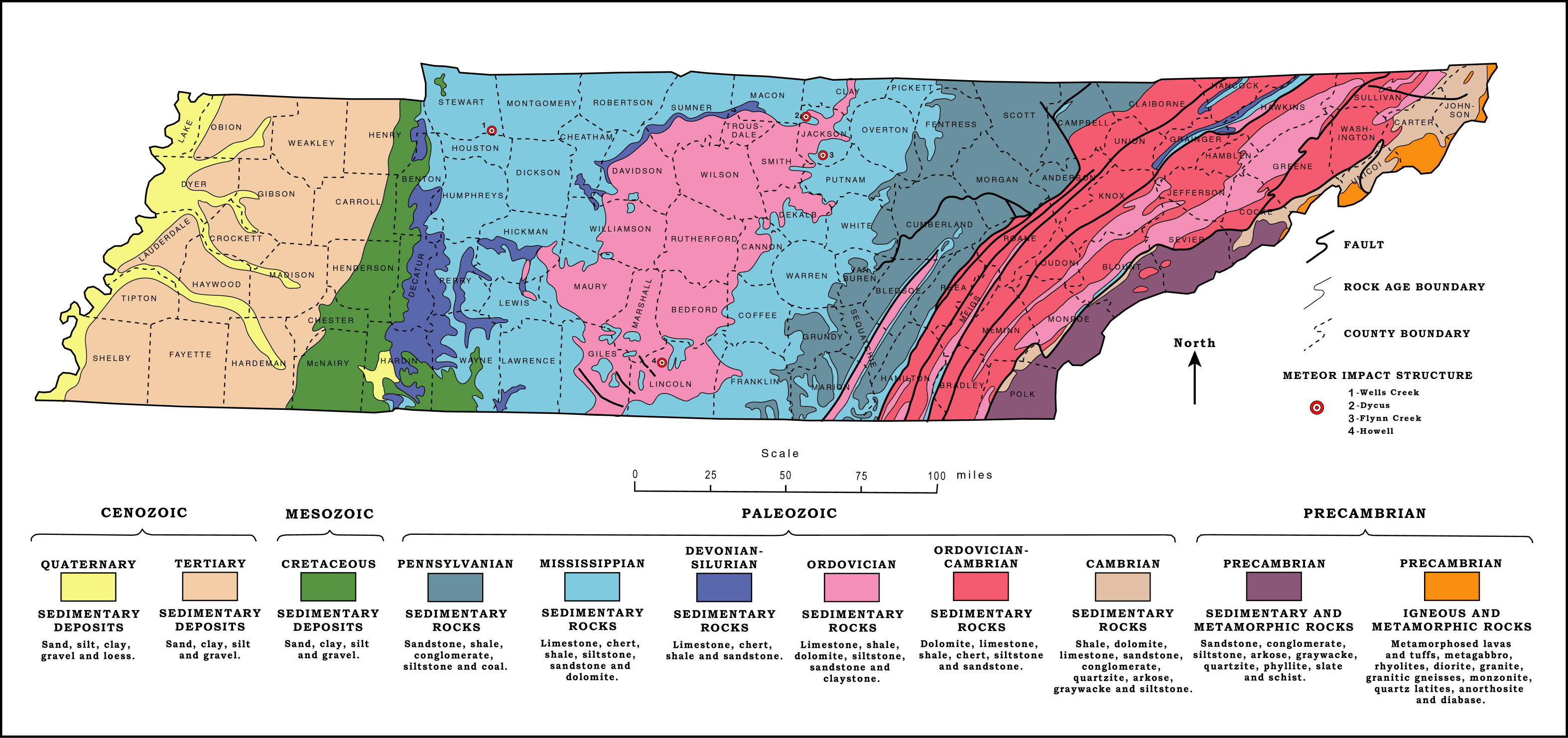
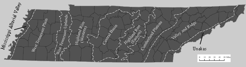
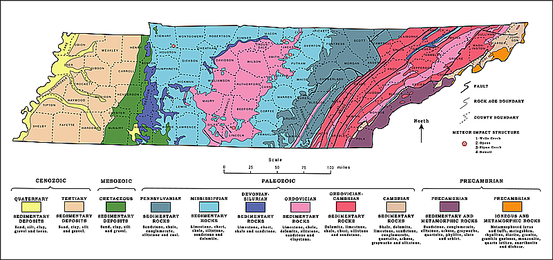
| Spanning 450 miles, Tennessee's geologic provinces each boast a unique history. After tectonic forces raised eastern Valley and Ridge provinces, central Tennessee was submerged to receive layered carbonate deposits left by ancient sea creatures. A volcanic plume later pushed these rocks up into huge dome that gradually eroded to form Nashville's central basin, exposing these fossils from the Ordovician period. The western provinces were again flooded by ocean during the age of dinosaurs, leaving Cretaceous fossil beds in sites like Coon Creek. Finally the Mississippi carved valley and flood terrain along the west. Click the color map below for details of Tennessee rocks, or Arrows to explore stratigraphic maps. |
|
 |
|
|